Wayfinding by the Rocks
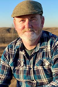
When the sun is shrouded by clouds, running your hand along each side of a solitary boulder to feel which is warmest can reaffirm your sense of direction. Stones placed atop each other to resemble people, called Inukshuks, point those trekking the blustery North to sacred lands. People have been using rocks and fossils to find their way for centuries, and professional geoscientist David Hills has always found himself guided by the Earth—and now he’s helping his fellow geoscientists, and all of Alberta, navigate using technology, mapping, and the rocks underfoot.
Some of his favourite finds from the Earth are the fossils of Amphipora—little hollow matchsticks, three millimetres wide, littered with sporadic, tiny holes. They are essentially sponges with skeletons made of calcium carbonates.
"I love them because they are a very good indicator of a particular type of environment. When you see them more than any other critter on the rocks that we have, in large numbers, I know the waters were shallow—maybe there was more salt. They could live where nothing else could. They were more tolerant of harsher conditions. When I'm working, there's a lot of hard things I must do, but when I see Amphipora, it's easy. I know exactly where we are."
Following a trail of stones
In a sense, rocks and fossils have always given Hills clear direction and guided him to the best places. As a child on holiday at the beach, he was fascinated by stones littering the sand. He loved going on field trips when he studied geology in secondary school in the United Kingdom.
Enrolled in engineering in university, Hills would often meander to another section of books farther down the library aisle. "I would start reading the geology books for a break," he confesses. It dawned on him his interests edged closer to the glint of a geode than the spark of an electrical current. He changed his major, even though at the time there were few career prospects for geoscientists. "I loved the science so much, and I decided it didn't matter if I didn't get a job in it. I wanted to pursue something I was truly interested in." His love of rocks led him on a cross-world journey when he moved to Alberta to earn his master's in earth and atmospheric sciences with a focus on carbonates at the University of Alberta. The significance of carbonates to the Canadian resources industry has solidified his presence in the country ever since.
His work in carbon capture and storage is breaking ground in a new territory of climate preservation. His project puts carbon dioxide back deep underground, into spent oil reservoirs, and he curiously, hopefully, scientifically observes the aftermath—and the additional oil that comes out. His team monitors the process, ensuring the land is safe for generations to come.
Geoscientists: the authors of the Earth
He postures a great geoscientist can change and shift like the very tectonic plates they study. "You need the ability to learn with what you're seeing and not be stubborn about what you think. You need to be open to the idea maybe previously you were wrong, and you have new ideas, and that is not a failing. That is an absolute commodity the best geologists have."
Perhaps this ability to see information in a fluid way pours from his artistic talents. He is a photographer capturing the ice-dappled Canada goose in a perfect third, a graphic designer showcasing a geological cross-section with specificity, an illustrator pausing for a moment of reflection on paper. He is also a writer. "You're in the science, trying to build a story from very little information. The story must be real, but there is an awful lot that must go into it. It takes an artistic frame of mind—a creativity. There is so much mystery with this science. We have ideas about how things looked or acted, and the chemistry and all of these things, but these events happened millions of years ago, and thousands and thousands of metres under our feet." Hills doesn’t like determinism in geoscience—rather, he says, success comes from examining the Earth's facts and findings and rolling with the many microseisms of new information and shifting learnings.
A map for Earth scientists
He carries his gift for artistry and passion for innovation into his contributions as graphic design lead and marketing lead of the Geological Atlas of the Western Canada Sedimentary Basin—a single-point source for information about the rocks under our feet in Western Canada. First published in 1994, it is being recreated for publication in 2027 and will include industry innovations of the past two decades.
"You've had whole industries come and go over that time. The new atlas is going to be a huge stimulus for activity in Western Canada. It’s a very important project for bringing eyes back to Alberta and seeing what the potential is here, in the rocks we have."
Hills, once again, is using the rocks around him to map a course—this time pointing fellow geologists and industry development to Alberta, one stone at a time.
Featured in this article

David Hills, P.Geo.
Read about how David Hills, P.Geo., is breaking new ground
Find out how Hills and his colleagues at Calgary-based Enhance Energy, used geological modelling to successfully design Alberta’s first fully integrated and large-scale carbon capture, utilization, and storage (CCUS) project.
