Webinar | Introduction to Geomodelling in Oil and Gas: A Bridge Between Geosciences and Engineering
Developing oil and gas reservoirs requires close collaboration between geoscientists and engineers. Many engineering tasks—like flow simulation, geomechanics, or reserve estimates—use a numerical 3D representation of the reservoir as an input. This representation of the reservoir is the geomodel—and it is the topic of this presentation, which is an updated version of past presentations on the same topic given through APEGA in 2021 and 2022.
The geomodel carries the interpretation built by the geoscientists and the engineers. As such, it is important that all in the asset team understand what a geomodel is, what the geomodelling workflow requires from them, and how they can review the model.
- First, using an outcrop example near Drumheller and then the Duvernay formation, the main concepts about geomodelling will be introduced.
- Second, the geomodelling workflow will be covered into more detail, from gathering the data to building the 3D grid and populating it with a facies model and then petrophysical properties such as porosity and permeability.
- Third, we will look at the importance of interpolation tools, and especially of geostatistical tools in geomodelling workflows, starting with 2D map interpolation before moving to how 3D grids are populated. No matter how sophisticated the algorithm run, the practitioner is ultimately responsible for validating the results. Several examples will illustrate the pitfalls to avoid on this matter.
- The final part will move to the review of geomodels. Once a geomodel is built by the geomodeller, it needs to be validated by the geoscientists and the engineers of the team. Does the geomodel capture the vision the team has about the geology of the reservoir? Is the geomodel fit for the tasks the engineers need it for? A methodology will be proposed to answer these questions.
This presentation is a must for anyone working in an oil and gas asset team, geomodellers and non-geomodellers alike. All the examples will be from Alberta.
This session will be held through ON24.
For any questions about this event, please contact [email protected].
About the Presenter
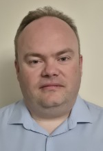 Thomas Jerome, P.Geo., has more than 25 years' experience as an independent senior oil and gas geomodelling consultant based in Calgary. Geologist by training, Thomas has spent all his career as a geomodeller, firstly in the Middle East, onsite in Saudi Aramco, before moving to Calgary in 2008. Since then, Thomas has served the Calgary oilpatch, first as an employee of Paradigm and then RPS Energy, before becoming independent in 2016. Over the last few years, Thomas has been increasingly involved in projects focusing on other resources like lithium production and CO2 sequestration.
This event applies to the following Work Readiness Program skill area: